

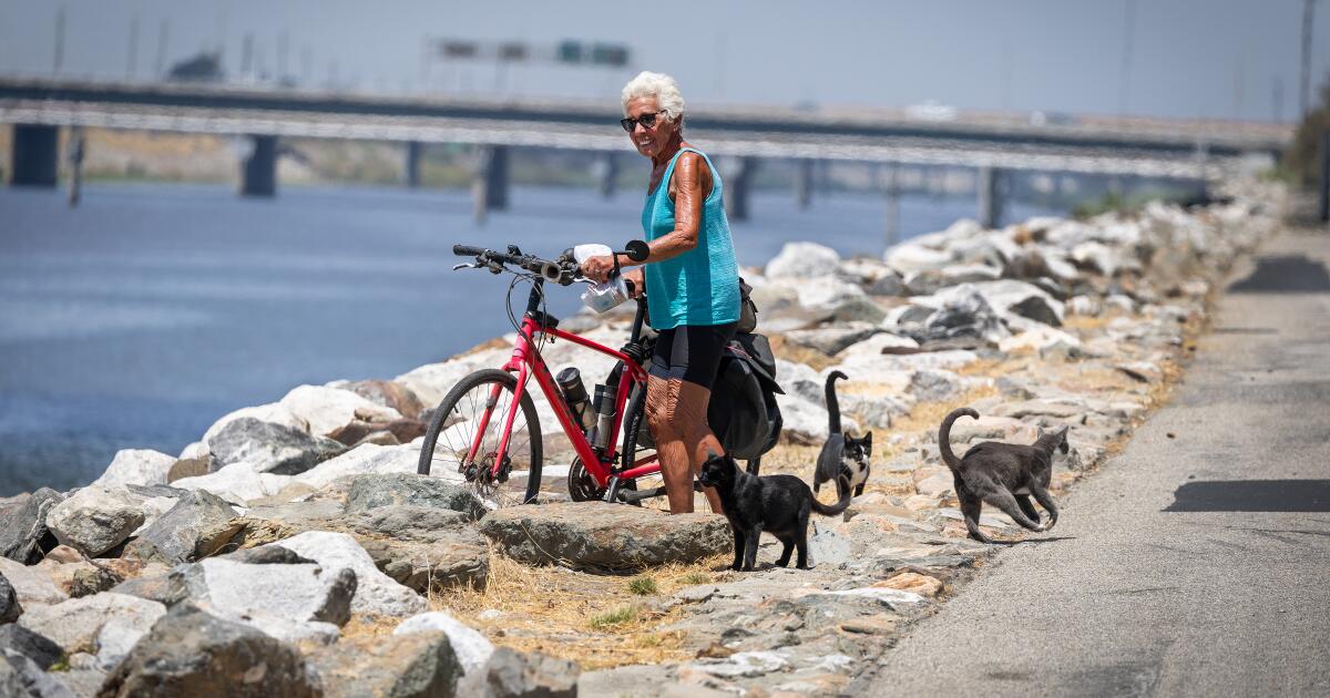

Someday, you might be able to ride a bike from the western San Fernando Valley to Long Beach along the Los Angeles River. But not yet.
The longest unfinished stretch is the eight miles from Elysian Park through downtown to Maywood. For decades, advocates of the path have tried to complete those eight miles along the concretized river.
Yet a decade later, the unrideable gap remains. The ambitious project remains mired in planning and bureaucratic complications, with groundbreaking still two years off and the cost nearly tripling to more than $1 billion — almost $24,000 per foot — documents reviewed by The Times show.
It looked like the prospects for the bike route to the sea were getting serious after Angelenos enthusiastically passed a half-cent tax for transit projects in 2016 that earmarked $365 million for the L.A. River Path.
At the time, the Metropolitan Transportation Authority, the lead on the project, priced out a simple path on one side of the river.
An aerial view of bicyclists where the Los Angeles River Path ends near Golden Shore and Shoreline Drive in Long Beach.
But by last year, the proposed designs were much wider and added seven pedestrian bridges. They also included sections where the path would be elevated above the ground, supported by beams. The changes responded to community input and comments from the U.S. Army Corps of Engineers and L.A. Department of Water and Power, among others. Estimated completion of the initial phase is not until 2031.
Navigating the web of nearby structures, like active rail lines and historic bridges, is part of what makes the construction so complex, Metro says. An original $75 million set aside for unforeseen expenses in 2016 swelled to $309 million last year, and the rising cost of construction also added to the high price tag.

Advocates for the path say this grander plan would be great, if there were a way to pay for it.
Yuval Bar-Zemer is a board member with Streets for All, a group that advocates for safer streets in L.A. He also is a downtown loft developer and commissioned studies that helped inform a far less expensive option that would run down near the flowing river, rather than up above. The path would be unusable during heavy rains, but Bar-Zemer and others say that would be less than 20 days each year.
This option was included in Metro’s initial scoping of the path in 2016 but has since been dropped, with the agency citing safety concerns. Bar-Zemer contends that safety features could be installed to make sure pedestrians have enough time to exit the pathway if water rises swiftly. He says he’s spent $350,000 of his own funds in engineering studies and advocacy to advance the path.

A pedestrian walks with an umbrella on the L.A. River Path near Lewis MacAdams Riverfront Park.
“The benefits are so obvious, it’s such a home run and such a low-hanging fruit that for me, it’s like criminal not to make it happen,” he said.
Currently, bikers headed southbound run out of path where Riverside Drive crosses the L.A. River at Egret Park. From there, they’re forced to weave through high-traffic streets in neighborhoods including Lincoln Heights, Chinatown, Downtown L.A. and Boyle Heights before they find the path again in Vernon.
“It’s a huge chasm,” said Michael Schneider, founder and chief executive of Streets for All. He called the gap in the L.A. River path “a shame because it’s an otherwise amazing resource.”
Some 76,000 residents live within walking distance of the proposed path, and a million within three miles of the L.A. River, according to Metro estimates from 2022. Around 17% of working-age people who live within a bikeable distance already walk, bike or take transit in their regular commute.

An aerial view of downtown Los Angeles and the Sixth Street Bridge amid an unfinished eight-mile gap in the L.A. River Path.
More recent numbers could be higher since high fuel prices have motivated many to use transit, bikes, e-bikes and scooters. The path also could provide recreational benefits to an area that has some of the most limited access to green space in Los Angeles.
Metro had the eight-mile gap on its list of 28 projects it wanted ready for the 2028 Olympic and Paralympic Games. As costs soared, it quietly was taken off the list.
Yet there are recent signs of progress for the L.A. River Path.
In late May, the Metro board voted to create a committee that brings together all the players needed to push it to toward completion.

The Los Angeles River runs under the Sixth Street Bridge amid an unfinished eight-mile gap in the L.A. River Path in downtown Los Angeles.
Mayor Karen Bass chairs the Metro board. Despite the project’s stagnation, she continues to convey optimism.
“Angelenos voted in 2016 to make the L.A. River Path path a reality, and Mayor Bass is marshaling the resources necessary to eliminate further distraction that have threatened the project’s pace and cost,” her office said in statement.
Metro staffers are reviewing comments on the draft environmental impact statement, the agency said. They intend to recommend a path forward in this fall.

Someday, you might be able to ride a bike from the western San Fernando Valley to Long Beach along the Los Angeles River. But not yet.
The longest unfinished stretch is the eight miles from Elysian Park through downtown to Maywood. For decades, advocates of the path have tried to complete those eight miles along the concretized river.
Yet a decade later, the unrideable gap remains. The ambitious project remains mired in planning and bureaucratic complications, with groundbreaking still two years off and the cost nearly tripling to more than $1 billion — almost $24,000 per foot — documents reviewed by The Times show.
It looked like the prospects for the bike route to the sea were getting serious after Angelenos enthusiastically passed a half-cent tax for transit projects in 2016 that earmarked $365 million for the L.A. River Path.
At the time, the Metropolitan Transportation Authority, the lead on the project, priced out a simple path on one side of the river.
An aerial view of bicyclists where the Los Angeles River Path ends near Golden Shore and Shoreline Drive in Long Beach.
But by last year, the proposed designs were much wider and added seven pedestrian bridges. They also included sections where the path would be elevated above the ground, supported by beams. The changes responded to community input and comments from the U.S. Army Corps of Engineers and L.A. Department of Water and Power, among others. Estimated completion of the initial phase is not until 2031.
Navigating the web of nearby structures, like active rail lines and historic bridges, is part of what makes the construction so complex, Metro says. An original $75 million set aside for unforeseen expenses in 2016 swelled to $309 million last year, and the rising cost of construction also added to the high price tag.
Advocates for the path say this grander plan would be great, if there were a way to pay for it.
Yuval Bar-Zemer is a board member with Streets for All, a group that advocates for safer streets in L.A. He also is a downtown loft developer and commissioned studies that helped inform a far less expensive option that would run down near the flowing river, rather than up above. The path would be unusable during heavy rains, but Bar-Zemer and others say that would be less than 20 days each year.
This option was included in Metro’s initial scoping of the path in 2016 but has since been dropped, with the agency citing safety concerns. Bar-Zemer contends that safety features could be installed to make sure pedestrians have enough time to exit the pathway if water rises swiftly. He says he’s spent $350,000 of his own funds in engineering studies and advocacy to advance the path.
A pedestrian walks with an umbrella on the L.A. River Path near Lewis MacAdams Riverfront Park.
“The benefits are so obvious, it’s such a home run and such a low-hanging fruit that for me, it’s like criminal not to make it happen,” he said.
Currently, bikers headed southbound run out of path where Riverside Drive crosses the L.A. River at Egret Park. From there, they’re forced to weave through high-traffic streets in neighborhoods including Lincoln Heights, Chinatown, Downtown L.A. and Boyle Heights before they find the path again in Vernon.
“It’s a huge chasm,” said Michael Schneider, founder and chief executive of Streets for All. He called the gap in the L.A. River path “a shame because it’s an otherwise amazing resource.”
Some 76,000 residents live within walking distance of the proposed path, and a million within three miles of the L.A. River, according to Metro estimates from 2022. Around 17% of working-age people who live within a bikeable distance already walk, bike or take transit in their regular commute.
An aerial view of downtown Los Angeles and the Sixth Street Bridge amid an unfinished eight-mile gap in the L.A. River Path.
More recent numbers could be higher since high fuel prices have motivated many to use transit, bikes, e-bikes and scooters. The path also could provide recreational benefits to an area that has some of the most limited access to green space in Los Angeles.
Metro had the eight-mile gap on its list of 28 projects it wanted ready for the 2028 Olympic and Paralympic Games. As costs soared, it quietly was taken off the list.
Yet there are recent signs of progress for the L.A. River Path.
In late May, the Metro board voted to create a committee that brings together all the players needed to push it to toward completion.
The Los Angeles River runs under the Sixth Street Bridge amid an unfinished eight-mile gap in the L.A. River Path in downtown Los Angeles.
Mayor Karen Bass chairs the Metro board. Despite the project’s stagnation, she continues to convey optimism.
“Angelenos voted in 2016 to make the L.A. River Path path a reality, and Mayor Bass is marshaling the resources necessary to eliminate further distraction that have threatened the project’s pace and cost,” her office said in statement.
Metro staffers are reviewing comments on the draft environmental impact statement, the agency said. They intend to recommend a path forward in this fall.

Someday, you might be able to ride a bike from the western San Fernando Valley to Long Beach along the Los Angeles River. But not yet.
The longest unfinished stretch is the eight miles from Elysian Park through downtown to Maywood. For decades, advocates of the path have tried to complete those eight miles along the concretized river.
Yet a decade later, the unrideable gap remains. The ambitious project remains mired in planning and bureaucratic complications, with groundbreaking still two years off and the cost nearly tripling to more than $1 billion — almost $24,000 per foot — documents reviewed by The Times show.
It looked like the prospects for the bike route to the sea were getting serious after Angelenos enthusiastically passed a half-cent tax for transit projects in 2016 that earmarked $365 million for the L.A. River Path.
At the time, the Metropolitan Transportation Authority, the lead on the project, priced out a simple path on one side of the river.
An aerial view of bicyclists where the Los Angeles River Path ends near Golden Shore and Shoreline Drive in Long Beach.
But by last year, the proposed designs were much wider and added seven pedestrian bridges. They also included sections where the path would be elevated above the ground, supported by beams. The changes responded to community input and comments from the U.S. Army Corps of Engineers and L.A. Department of Water and Power, among others. Estimated completion of the initial phase is not until 2031.
Navigating the web of nearby structures, like active rail lines and historic bridges, is part of what makes the construction so complex, Metro says. An original $75 million set aside for unforeseen expenses in 2016 swelled to $309 million last year, and the rising cost of construction also added to the high price tag.
Advocates for the path say this grander plan would be great, if there were a way to pay for it.
Yuval Bar-Zemer is a board member with Streets for All, a group that advocates for safer streets in L.A. He also is a downtown loft developer and commissioned studies that helped inform a far less expensive option that would run down near the flowing river, rather than up above. The path would be unusable during heavy rains, but Bar-Zemer and others say that would be less than 20 days each year.
This option was included in Metro’s initial scoping of the path in 2016 but has since been dropped, with the agency citing safety concerns. Bar-Zemer contends that safety features could be installed to make sure pedestrians have enough time to exit the pathway if water rises swiftly. He says he’s spent $350,000 of his own funds in engineering studies and advocacy to advance the path.
A pedestrian walks with an umbrella on the L.A. River Path near Lewis MacAdams Riverfront Park.
“The benefits are so obvious, it’s such a home run and such a low-hanging fruit that for me, it’s like criminal not to make it happen,” he said.
Currently, bikers headed southbound run out of path where Riverside Drive crosses the L.A. River at Egret Park. From there, they’re forced to weave through high-traffic streets in neighborhoods including Lincoln Heights, Chinatown, Downtown L.A. and Boyle Heights before they find the path again in Vernon.
“It’s a huge chasm,” said Michael Schneider, founder and chief executive of Streets for All. He called the gap in the L.A. River path “a shame because it’s an otherwise amazing resource.”
Some 76,000 residents live within walking distance of the proposed path, and a million within three miles of the L.A. River, according to Metro estimates from 2022. Around 17% of working-age people who live within a bikeable distance already walk, bike or take transit in their regular commute.
An aerial view of downtown Los Angeles and the Sixth Street Bridge amid an unfinished eight-mile gap in the L.A. River Path.
More recent numbers could be higher since high fuel prices have motivated many to use transit, bikes, e-bikes and scooters. The path also could provide recreational benefits to an area that has some of the most limited access to green space in Los Angeles.
Metro had the eight-mile gap on its list of 28 projects it wanted ready for the 2028 Olympic and Paralympic Games. As costs soared, it quietly was taken off the list.
Yet there are recent signs of progress for the L.A. River Path.
In late May, the Metro board voted to create a committee that brings together all the players needed to push it to toward completion.
The Los Angeles River runs under the Sixth Street Bridge amid an unfinished eight-mile gap in the L.A. River Path in downtown Los Angeles.
Mayor Karen Bass chairs the Metro board. Despite the project’s stagnation, she continues to convey optimism.
“Angelenos voted in 2016 to make the L.A. River Path path a reality, and Mayor Bass is marshaling the resources necessary to eliminate further distraction that have threatened the project’s pace and cost,” her office said in statement.
Metro staffers are reviewing comments on the draft environmental impact statement, the agency said. They intend to recommend a path forward in this fall.
Someday, you might be able to ride a bike from the western San Fernando Valley to Long Beach along the Los Angeles River. But not yet.
The longest unfinished stretch is the eight miles from Elysian Park through downtown to Maywood. For decades, advocates of the path have tried to complete those eight miles along the concretized river.
Yet a decade later, the unrideable gap remains. The ambitious project remains mired in planning and bureaucratic complications, with groundbreaking still two years off and the cost nearly tripling to more than $1 billion — almost $24,000 per foot — documents reviewed by The Times show.
It looked like the prospects for the bike route to the sea were getting serious after Angelenos enthusiastically passed a half-cent tax for transit projects in 2016 that earmarked $365 million for the L.A. River Path.
At the time, the Metropolitan Transportation Authority, the lead on the project, priced out a simple path on one side of the river.
An aerial view of bicyclists where the Los Angeles River Path ends near Golden Shore and Shoreline Drive in Long Beach.
But by last year, the proposed designs were much wider and added seven pedestrian bridges. They also included sections where the path would be elevated above the ground, supported by beams. The changes responded to community input and comments from the U.S. Army Corps of Engineers and L.A. Department of Water and Power, among others. Estimated completion of the initial phase is not until 2031.
Navigating the web of nearby structures, like active rail lines and historic bridges, is part of what makes the construction so complex, Metro says. An original $75 million set aside for unforeseen expenses in 2016 swelled to $309 million last year, and the rising cost of construction also added to the high price tag.
Advocates for the path say this grander plan would be great, if there were a way to pay for it.
Yuval Bar-Zemer is a board member with Streets for All, a group that advocates for safer streets in L.A. He also is a downtown loft developer and commissioned studies that helped inform a far less expensive option that would run down near the flowing river, rather than up above. The path would be unusable during heavy rains, but Bar-Zemer and others say that would be less than 20 days each year.
This option was included in Metro’s initial scoping of the path in 2016 but has since been dropped, with the agency citing safety concerns. Bar-Zemer contends that safety features could be installed to make sure pedestrians have enough time to exit the pathway if water rises swiftly. He says he’s spent $350,000 of his own funds in engineering studies and advocacy to advance the path.
A pedestrian walks with an umbrella on the L.A. River Path near Lewis MacAdams Riverfront Park.
“The benefits are so obvious, it’s such a home run and such a low-hanging fruit that for me, it’s like criminal not to make it happen,” he said.
Currently, bikers headed southbound run out of path where Riverside Drive crosses the L.A. River at Egret Park. From there, they’re forced to weave through high-traffic streets in neighborhoods including Lincoln Heights, Chinatown, Downtown L.A. and Boyle Heights before they find the path again in Vernon.
“It’s a huge chasm,” said Michael Schneider, founder and chief executive of Streets for All. He called the gap in the L.A. River path “a shame because it’s an otherwise amazing resource.”
Some 76,000 residents live within walking distance of the proposed path, and a million within three miles of the L.A. River, according to Metro estimates from 2022. Around 17% of working-age people who live within a bikeable distance already walk, bike or take transit in their regular commute.
An aerial view of downtown Los Angeles and the Sixth Street Bridge amid an unfinished eight-mile gap in the L.A. River Path.
More recent numbers could be higher since high fuel prices have motivated many to use transit, bikes, e-bikes and scooters. The path also could provide recreational benefits to an area that has some of the most limited access to green space in Los Angeles.
Metro had the eight-mile gap on its list of 28 projects it wanted ready for the 2028 Olympic and Paralympic Games. As costs soared, it quietly was taken off the list.
Yet there are recent signs of progress for the L.A. River Path.
In late May, the Metro board voted to create a committee that brings together all the players needed to push it to toward completion.
The Los Angeles River runs under the Sixth Street Bridge amid an unfinished eight-mile gap in the L.A. River Path in downtown Los Angeles.
Mayor Karen Bass chairs the Metro board. Despite the project’s stagnation, she continues to convey optimism.
“Angelenos voted in 2016 to make the L.A. River Path path a reality, and Mayor Bass is marshaling the resources necessary to eliminate further distraction that have threatened the project’s pace and cost,” her office said in statement.
Metro staffers are reviewing comments on the draft environmental impact statement, the agency said. They intend to recommend a path forward in this fall.

Someday, you might be able to ride a bike from the western San Fernando Valley to Long Beach along the Los Angeles River. But not yet.
The longest unfinished stretch is the eight miles from Elysian Park through downtown to Maywood. For decades, advocates of the path have tried to complete those eight miles along the concretized river.
Yet a decade later, the unrideable gap remains. The ambitious project remains mired in planning and bureaucratic complications, with groundbreaking still two years off and the cost nearly tripling to more than $1 billion — almost $24,000 per foot — documents reviewed by The Times show.
It looked like the prospects for the bike route to the sea were getting serious after Angelenos enthusiastically passed a half-cent tax for transit projects in 2016 that earmarked $365 million for the L.A. River Path.
At the time, the Metropolitan Transportation Authority, the lead on the project, priced out a simple path on one side of the river.
An aerial view of bicyclists where the Los Angeles River Path ends near Golden Shore and Shoreline Drive in Long Beach.
But by last year, the proposed designs were much wider and added seven pedestrian bridges. They also included sections where the path would be elevated above the ground, supported by beams. The changes responded to community input and comments from the U.S. Army Corps of Engineers and L.A. Department of Water and Power, among others. Estimated completion of the initial phase is not until 2031.
Navigating the web of nearby structures, like active rail lines and historic bridges, is part of what makes the construction so complex, Metro says. An original $75 million set aside for unforeseen expenses in 2016 swelled to $309 million last year, and the rising cost of construction also added to the high price tag.
Advocates for the path say this grander plan would be great, if there were a way to pay for it.
Yuval Bar-Zemer is a board member with Streets for All, a group that advocates for safer streets in L.A. He also is a downtown loft developer and commissioned studies that helped inform a far less expensive option that would run down near the flowing river, rather than up above. The path would be unusable during heavy rains, but Bar-Zemer and others say that would be less than 20 days each year.
This option was included in Metro’s initial scoping of the path in 2016 but has since been dropped, with the agency citing safety concerns. Bar-Zemer contends that safety features could be installed to make sure pedestrians have enough time to exit the pathway if water rises swiftly. He says he’s spent $350,000 of his own funds in engineering studies and advocacy to advance the path.
A pedestrian walks with an umbrella on the L.A. River Path near Lewis MacAdams Riverfront Park.
“The benefits are so obvious, it’s such a home run and such a low-hanging fruit that for me, it’s like criminal not to make it happen,” he said.
Currently, bikers headed southbound run out of path where Riverside Drive crosses the L.A. River at Egret Park. From there, they’re forced to weave through high-traffic streets in neighborhoods including Lincoln Heights, Chinatown, Downtown L.A. and Boyle Heights before they find the path again in Vernon.
“It’s a huge chasm,” said Michael Schneider, founder and chief executive of Streets for All. He called the gap in the L.A. River path “a shame because it’s an otherwise amazing resource.”
Some 76,000 residents live within walking distance of the proposed path, and a million within three miles of the L.A. River, according to Metro estimates from 2022. Around 17% of working-age people who live within a bikeable distance already walk, bike or take transit in their regular commute.
An aerial view of downtown Los Angeles and the Sixth Street Bridge amid an unfinished eight-mile gap in the L.A. River Path.
More recent numbers could be higher since high fuel prices have motivated many to use transit, bikes, e-bikes and scooters. The path also could provide recreational benefits to an area that has some of the most limited access to green space in Los Angeles.
Metro had the eight-mile gap on its list of 28 projects it wanted ready for the 2028 Olympic and Paralympic Games. As costs soared, it quietly was taken off the list.
Yet there are recent signs of progress for the L.A. River Path.
In late May, the Metro board voted to create a committee that brings together all the players needed to push it to toward completion.
The Los Angeles River runs under the Sixth Street Bridge amid an unfinished eight-mile gap in the L.A. River Path in downtown Los Angeles.
Mayor Karen Bass chairs the Metro board. Despite the project’s stagnation, she continues to convey optimism.
“Angelenos voted in 2016 to make the L.A. River Path path a reality, and Mayor Bass is marshaling the resources necessary to eliminate further distraction that have threatened the project’s pace and cost,” her office said in statement.
Metro staffers are reviewing comments on the draft environmental impact statement, the agency said. They intend to recommend a path forward in this fall.
Someday, you might be able to ride a bike from the western San Fernando Valley to Long Beach along the Los Angeles River. But not yet.
The longest unfinished stretch is the eight miles from Elysian Park through downtown to Maywood. For decades, advocates of the path have tried to complete those eight miles along the concretized river.
Yet a decade later, the unrideable gap remains. The ambitious project remains mired in planning and bureaucratic complications, with groundbreaking still two years off and the cost nearly tripling to more than $1 billion — almost $24,000 per foot — documents reviewed by The Times show.
It looked like the prospects for the bike route to the sea were getting serious after Angelenos enthusiastically passed a half-cent tax for transit projects in 2016 that earmarked $365 million for the L.A. River Path.
At the time, the Metropolitan Transportation Authority, the lead on the project, priced out a simple path on one side of the river.
An aerial view of bicyclists where the Los Angeles River Path ends near Golden Shore and Shoreline Drive in Long Beach.
But by last year, the proposed designs were much wider and added seven pedestrian bridges. They also included sections where the path would be elevated above the ground, supported by beams. The changes responded to community input and comments from the U.S. Army Corps of Engineers and L.A. Department of Water and Power, among others. Estimated completion of the initial phase is not until 2031.
Navigating the web of nearby structures, like active rail lines and historic bridges, is part of what makes the construction so complex, Metro says. An original $75 million set aside for unforeseen expenses in 2016 swelled to $309 million last year, and the rising cost of construction also added to the high price tag.
Advocates for the path say this grander plan would be great, if there were a way to pay for it.
Yuval Bar-Zemer is a board member with Streets for All, a group that advocates for safer streets in L.A. He also is a downtown loft developer and commissioned studies that helped inform a far less expensive option that would run down near the flowing river, rather than up above. The path would be unusable during heavy rains, but Bar-Zemer and others say that would be less than 20 days each year.
This option was included in Metro’s initial scoping of the path in 2016 but has since been dropped, with the agency citing safety concerns. Bar-Zemer contends that safety features could be installed to make sure pedestrians have enough time to exit the pathway if water rises swiftly. He says he’s spent $350,000 of his own funds in engineering studies and advocacy to advance the path.
A pedestrian walks with an umbrella on the L.A. River Path near Lewis MacAdams Riverfront Park.
“The benefits are so obvious, it’s such a home run and such a low-hanging fruit that for me, it’s like criminal not to make it happen,” he said.
Currently, bikers headed southbound run out of path where Riverside Drive crosses the L.A. River at Egret Park. From there, they’re forced to weave through high-traffic streets in neighborhoods including Lincoln Heights, Chinatown, Downtown L.A. and Boyle Heights before they find the path again in Vernon.
“It’s a huge chasm,” said Michael Schneider, founder and chief executive of Streets for All. He called the gap in the L.A. River path “a shame because it’s an otherwise amazing resource.”
Some 76,000 residents live within walking distance of the proposed path, and a million within three miles of the L.A. River, according to Metro estimates from 2022. Around 17% of working-age people who live within a bikeable distance already walk, bike or take transit in their regular commute.
An aerial view of downtown Los Angeles and the Sixth Street Bridge amid an unfinished eight-mile gap in the L.A. River Path.
More recent numbers could be higher since high fuel prices have motivated many to use transit, bikes, e-bikes and scooters. The path also could provide recreational benefits to an area that has some of the most limited access to green space in Los Angeles.
Metro had the eight-mile gap on its list of 28 projects it wanted ready for the 2028 Olympic and Paralympic Games. As costs soared, it quietly was taken off the list.
Yet there are recent signs of progress for the L.A. River Path.
In late May, the Metro board voted to create a committee that brings together all the players needed to push it to toward completion.
The Los Angeles River runs under the Sixth Street Bridge amid an unfinished eight-mile gap in the L.A. River Path in downtown Los Angeles.
Mayor Karen Bass chairs the Metro board. Despite the project’s stagnation, she continues to convey optimism.
“Angelenos voted in 2016 to make the L.A. River Path path a reality, and Mayor Bass is marshaling the resources necessary to eliminate further distraction that have threatened the project’s pace and cost,” her office said in statement.
Metro staffers are reviewing comments on the draft environmental impact statement, the agency said. They intend to recommend a path forward in this fall.
Someday, you might be able to ride a bike from the western San Fernando Valley to Long Beach along the Los Angeles River. But not yet.
The longest unfinished stretch is the eight miles from Elysian Park through downtown to Maywood. For decades, advocates of the path have tried to complete those eight miles along the concretized river.
Yet a decade later, the unrideable gap remains. The ambitious project remains mired in planning and bureaucratic complications, with groundbreaking still two years off and the cost nearly tripling to more than $1 billion — almost $24,000 per foot — documents reviewed by The Times show.
It looked like the prospects for the bike route to the sea were getting serious after Angelenos enthusiastically passed a half-cent tax for transit projects in 2016 that earmarked $365 million for the L.A. River Path.
At the time, the Metropolitan Transportation Authority, the lead on the project, priced out a simple path on one side of the river.
An aerial view of bicyclists where the Los Angeles River Path ends near Golden Shore and Shoreline Drive in Long Beach.
But by last year, the proposed designs were much wider and added seven pedestrian bridges. They also included sections where the path would be elevated above the ground, supported by beams. The changes responded to community input and comments from the U.S. Army Corps of Engineers and L.A. Department of Water and Power, among others. Estimated completion of the initial phase is not until 2031.
Navigating the web of nearby structures, like active rail lines and historic bridges, is part of what makes the construction so complex, Metro says. An original $75 million set aside for unforeseen expenses in 2016 swelled to $309 million last year, and the rising cost of construction also added to the high price tag.
Advocates for the path say this grander plan would be great, if there were a way to pay for it.
Yuval Bar-Zemer is a board member with Streets for All, a group that advocates for safer streets in L.A. He also is a downtown loft developer and commissioned studies that helped inform a far less expensive option that would run down near the flowing river, rather than up above. The path would be unusable during heavy rains, but Bar-Zemer and others say that would be less than 20 days each year.
This option was included in Metro’s initial scoping of the path in 2016 but has since been dropped, with the agency citing safety concerns. Bar-Zemer contends that safety features could be installed to make sure pedestrians have enough time to exit the pathway if water rises swiftly. He says he’s spent $350,000 of his own funds in engineering studies and advocacy to advance the path.
A pedestrian walks with an umbrella on the L.A. River Path near Lewis MacAdams Riverfront Park.
“The benefits are so obvious, it’s such a home run and such a low-hanging fruit that for me, it’s like criminal not to make it happen,” he said.
Currently, bikers headed southbound run out of path where Riverside Drive crosses the L.A. River at Egret Park. From there, they’re forced to weave through high-traffic streets in neighborhoods including Lincoln Heights, Chinatown, Downtown L.A. and Boyle Heights before they find the path again in Vernon.
“It’s a huge chasm,” said Michael Schneider, founder and chief executive of Streets for All. He called the gap in the L.A. River path “a shame because it’s an otherwise amazing resource.”
Some 76,000 residents live within walking distance of the proposed path, and a million within three miles of the L.A. River, according to Metro estimates from 2022. Around 17% of working-age people who live within a bikeable distance already walk, bike or take transit in their regular commute.
An aerial view of downtown Los Angeles and the Sixth Street Bridge amid an unfinished eight-mile gap in the L.A. River Path.
More recent numbers could be higher since high fuel prices have motivated many to use transit, bikes, e-bikes and scooters. The path also could provide recreational benefits to an area that has some of the most limited access to green space in Los Angeles.
Metro had the eight-mile gap on its list of 28 projects it wanted ready for the 2028 Olympic and Paralympic Games. As costs soared, it quietly was taken off the list.
Yet there are recent signs of progress for the L.A. River Path.
In late May, the Metro board voted to create a committee that brings together all the players needed to push it to toward completion.
The Los Angeles River runs under the Sixth Street Bridge amid an unfinished eight-mile gap in the L.A. River Path in downtown Los Angeles.
Mayor Karen Bass chairs the Metro board. Despite the project’s stagnation, she continues to convey optimism.
“Angelenos voted in 2016 to make the L.A. River Path path a reality, and Mayor Bass is marshaling the resources necessary to eliminate further distraction that have threatened the project’s pace and cost,” her office said in statement.
Metro staffers are reviewing comments on the draft environmental impact statement, the agency said. They intend to recommend a path forward in this fall.
Someday, you might be able to ride a bike from the western San Fernando Valley to Long Beach along the Los Angeles River. But not yet.
The longest unfinished stretch is the eight miles from Elysian Park through downtown to Maywood. For decades, advocates of the path have tried to complete those eight miles along the concretized river.
Yet a decade later, the unrideable gap remains. The ambitious project remains mired in planning and bureaucratic complications, with groundbreaking still two years off and the cost nearly tripling to more than $1 billion — almost $24,000 per foot — documents reviewed by The Times show.
It looked like the prospects for the bike route to the sea were getting serious after Angelenos enthusiastically passed a half-cent tax for transit projects in 2016 that earmarked $365 million for the L.A. River Path.
At the time, the Metropolitan Transportation Authority, the lead on the project, priced out a simple path on one side of the river.
An aerial view of bicyclists where the Los Angeles River Path ends near Golden Shore and Shoreline Drive in Long Beach.
But by last year, the proposed designs were much wider and added seven pedestrian bridges. They also included sections where the path would be elevated above the ground, supported by beams. The changes responded to community input and comments from the U.S. Army Corps of Engineers and L.A. Department of Water and Power, among others. Estimated completion of the initial phase is not until 2031.
Navigating the web of nearby structures, like active rail lines and historic bridges, is part of what makes the construction so complex, Metro says. An original $75 million set aside for unforeseen expenses in 2016 swelled to $309 million last year, and the rising cost of construction also added to the high price tag.
Advocates for the path say this grander plan would be great, if there were a way to pay for it.
Yuval Bar-Zemer is a board member with Streets for All, a group that advocates for safer streets in L.A. He also is a downtown loft developer and commissioned studies that helped inform a far less expensive option that would run down near the flowing river, rather than up above. The path would be unusable during heavy rains, but Bar-Zemer and others say that would be less than 20 days each year.
This option was included in Metro’s initial scoping of the path in 2016 but has since been dropped, with the agency citing safety concerns. Bar-Zemer contends that safety features could be installed to make sure pedestrians have enough time to exit the pathway if water rises swiftly. He says he’s spent $350,000 of his own funds in engineering studies and advocacy to advance the path.
A pedestrian walks with an umbrella on the L.A. River Path near Lewis MacAdams Riverfront Park.
“The benefits are so obvious, it’s such a home run and such a low-hanging fruit that for me, it’s like criminal not to make it happen,” he said.
Currently, bikers headed southbound run out of path where Riverside Drive crosses the L.A. River at Egret Park. From there, they’re forced to weave through high-traffic streets in neighborhoods including Lincoln Heights, Chinatown, Downtown L.A. and Boyle Heights before they find the path again in Vernon.
“It’s a huge chasm,” said Michael Schneider, founder and chief executive of Streets for All. He called the gap in the L.A. River path “a shame because it’s an otherwise amazing resource.”
Some 76,000 residents live within walking distance of the proposed path, and a million within three miles of the L.A. River, according to Metro estimates from 2022. Around 17% of working-age people who live within a bikeable distance already walk, bike or take transit in their regular commute.
An aerial view of downtown Los Angeles and the Sixth Street Bridge amid an unfinished eight-mile gap in the L.A. River Path.
More recent numbers could be higher since high fuel prices have motivated many to use transit, bikes, e-bikes and scooters. The path also could provide recreational benefits to an area that has some of the most limited access to green space in Los Angeles.
Metro had the eight-mile gap on its list of 28 projects it wanted ready for the 2028 Olympic and Paralympic Games. As costs soared, it quietly was taken off the list.
Yet there are recent signs of progress for the L.A. River Path.
In late May, the Metro board voted to create a committee that brings together all the players needed to push it to toward completion.
The Los Angeles River runs under the Sixth Street Bridge amid an unfinished eight-mile gap in the L.A. River Path in downtown Los Angeles.
Mayor Karen Bass chairs the Metro board. Despite the project’s stagnation, she continues to convey optimism.
“Angelenos voted in 2016 to make the L.A. River Path path a reality, and Mayor Bass is marshaling the resources necessary to eliminate further distraction that have threatened the project’s pace and cost,” her office said in statement.
Metro staffers are reviewing comments on the draft environmental impact statement, the agency said. They intend to recommend a path forward in this fall.